UAV Sample Dataset
We are providing three UAV datasets. These datasets were collected by DJI Phantom 4pro and DJI Inspire 2. The images were processed using Pix4Dmapper Pro version 4.3.31. Anyone who wants to access these datasets should request through mail at info.uasg2021@iitr.ac.in with subject "Request for Datasets_itemno_X" for acquiring the datasets and the rights to use it. The request mail should also include a consent that the user will acknowledge the data provider wherever he/she will use it. In freely using the materials, we require that you give appropriate credit. The dataset provided is just for research purposes and will not be used in any commercial demonstration elsewhere. In case of any publication using these datasets, in UASG 2021 or elsewhere, the authors must acknowledge Dr. Kamal Jain, Professor, Indian Institute of Technology-Roorkee, as the data provider.
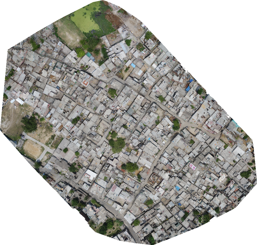
Item No. 01
Number of Images: 102 Average GSD: 1.79 cm Area Covered: 0.061 km2 Flying Height: 150 m Information: This dataset consists of images of a highly dense urban area.Cite as: Jain, Kamal (2021), Dense Urban dataset for Khanjarpur area (Roorkee).
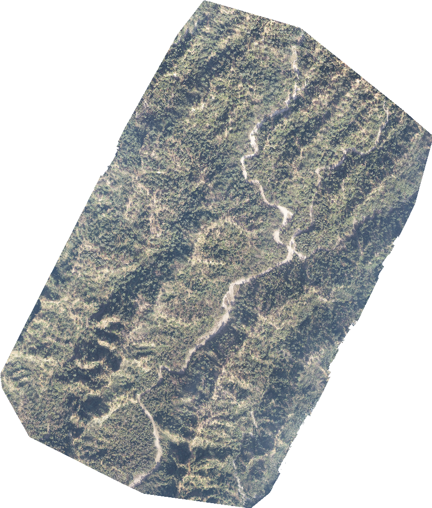
Item No. 02
Number of Images: 60 Average GSD: 11.86 cm Area Covered: 2.040 km2 Flying Height: 300 m Information: This dataset consists of images of a dense forested mountain area.Cite as: Jain, Kamal (2021), Forests and Mountains dataset for Nagli area (Haryana).
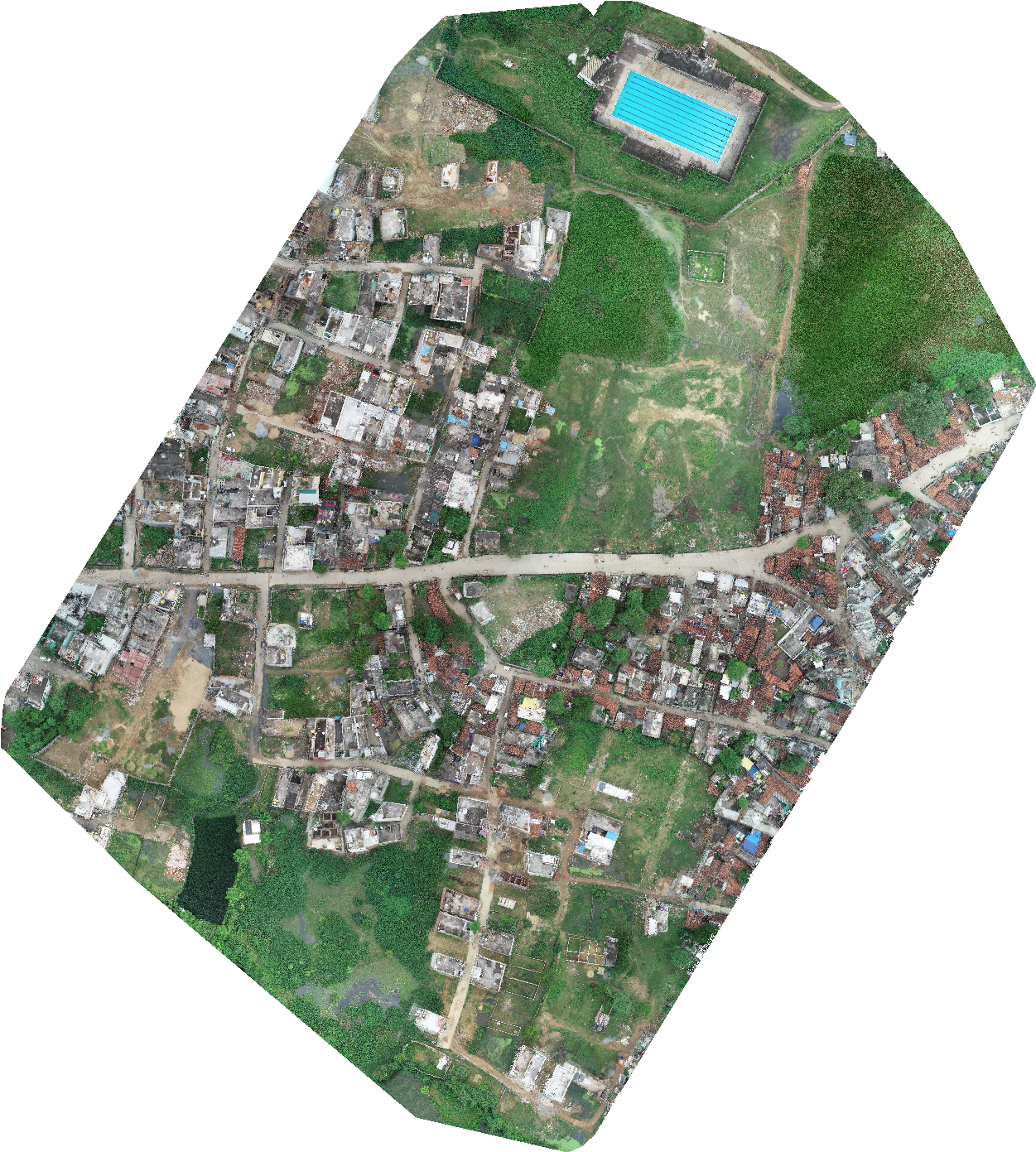
Item No. 03
Number of Images: 85 Average GSD: 2.19 cm Area Covered: 0.130 km2 Flying Height: 100 m Information: This dataset consists of images of a slum area with sub-urban features.Cite as: Jain, Kamal (2021), Urban Slum dataset for Chingrajpara slum area (Chhattisgarh).